Discover Morocco
Morocco's Geography and Landscapes
A journey across Morocco can pass from ocean air to high mountain country, irrigated farmland and open desert. These are connected landscapes: mountains collect water, rivers feed plains, and coasts link towns to the wider world.
Two coastlines, several coastal worlds
The Atlantic runs along Morocco's western side, past cities including Rabat, Casablanca, Essaouira and Agadir. Long beaches alternate with rocky stretches, cliffs, river mouths and ports. The coast is a place of work and settlement as well as holidays: fishing harbours, commercial cities and farming districts share the same ocean frontage.
Along the Mediterranean, the Rif comes close to the sea, creating a different pattern of headlands, bays and coastal towns. Tangier sits beside the Strait of Gibraltar, where Atlantic and Mediterranean routes meet. Further east, the landscapes around Al Hoceima and towards Saïdia belong to this northern coastal world.
Neither coast has one climate. Ocean influence can moderate temperatures, but wind, exposure and latitude matter. A breezy afternoon in Essaouira and a summer day in a sheltered Mediterranean bay are different experiences, even before you head inland.
The Rif and the Atlas ranges
The Rif forms the mountain country of the north. The Atlas is a separate system, with three main ranges: the Middle Atlas, High Atlas and Anti-Atlas. Thinking of them as one continuous hiking destination misses their differences in altitude, vegetation and access.
The Middle Atlas has upland forests, lakes and plateaux around places such as Ifrane and Azrou. The High Atlas rises across the centre of the country and includes Jbel Toubkal, Morocco's highest summit. Its ridges and passes separate regions that may look close together on a small map.
Further south-west, the Anti-Atlas has a generally drier character, with exposed rock, valleys and settlements around places such as Tafraoute. Mountain communities are connected to farming, markets and nearby towns; they are not isolated from the rest of contemporary Morocco.

Plains and valleys are part of the picture
Between the mountains and coasts lie agricultural plains and broad valleys. In the north-west, the Sebou basin links the Middle Atlas and Rif foothills to the Gharb plain and the Atlantic. Around Fes and Meknes, the Saïss is another important lowland landscape. These areas help explain why farming and large settlements are not confined to narrow strips beside the sea.
The Souss plain lies between the High Atlas and Anti-Atlas, opening towards Agadir and the Atlantic. Irrigated agriculture there has developed alongside mountain and oasis farming. A green field does not necessarily mean a wet climate: irrigation can make productive land in a region where rainfall alone would not support the same crops.
Water connects the regions
Mountain catchments, river basins, reservoirs and groundwater connect landscapes that otherwise seem separate. Water from upland areas supports settlements and agriculture downstream. The Sebou, for example, gathers tributaries from contrasting terrain before reaching the ocean near Kénitra.
Rainfall varies strongly between regions and between years. The greener north and mountain slopes should not be read as a picture of the whole country. Equally, a dry riverbed on one visit does not describe what that watercourse can do during heavy rain. Water availability helps shape where people cultivate land and how they manage it.
Oases, stony country and Saharan landscapes
South and east of the High Atlas, the landscape becomes more arid. Valleys and oases around the Drâa and Tafilalet concentrate cultivation and settlement around water. Palm groves are working agricultural spaces, rather than simply scenery between desert excursions.
Sand dunes such as those around Merzouga are striking, but they are only one kind of desert terrain. Rocky ground, gravel plains and broad plateaux also belong to the arid landscape. Along the southern Atlantic, places such as Dakhla show another meeting of Sahara and ocean: desert conditions do not always mean being far from the coast.
Reading the landscape as you travel
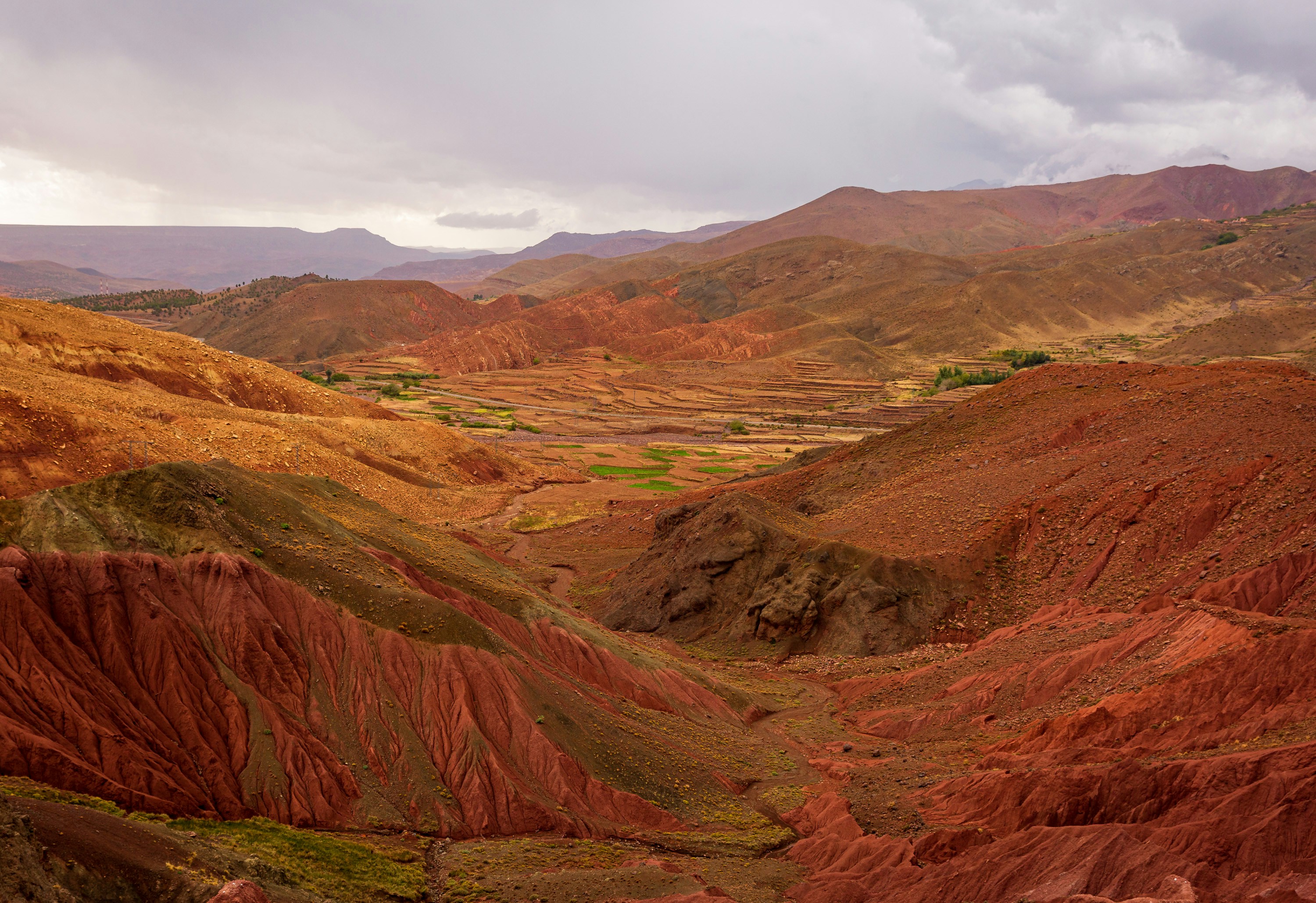
Looking at the route between cities often tells you more than a list of landmarks. Travelling from Marrakech towards Ouarzazate means crossing the High Atlas before reaching a much drier landscape south of the mountains. The change in vegetation, settlement and building materials is part of the journey, not simply the space between two stops.
Fes and the surrounding Saïss plain offer another contrast. The city sits within a wider agricultural region, with upland landscapes to the south and the Rif to the north. Near Agadir, the Souss plain links the Atlantic coast to inland farms and villages, while the Anti-Atlas begins further south. Seeing how towns depend on their surroundings makes geography easier to understand.
Distances can mislead when a route crosses a mountain pass or follows a winding valley. For a road trip, plan using actual travel times, local conditions and daylight rather than assuming two places that look close on a map make an easy day out.
Season and altitude change what you experience
Much of Morocco receives most of its rain in the cooler part of the year, while summers are generally drier. Inland places can have stronger temperature contrasts than coastal ones. Mountains add another dimension: conditions at a high pass can be very different from those in a nearby lower valley.
Winter snow is part of Moroccan mountain geography. Summer heat is a serious consideration in inland and desert regions, while sea breezes can make parts of the coast feel cooler. A national weather average is therefore a poor guide to a journey that crosses several regions.
For practical planning, compare the coast or valley, the altitude and the season for each stop. Use our climate and best-time-to-visit guide for timing, and the hiking hub for mountain activities.
Three journeys that explain the country
For a first sense of the Atlantic coast, follow the corridor from Rabat through Casablanca towards Essaouira. Ports, beaches and city streets are close together, but the experience changes with the wind, urban development and the shape of the shoreline.
For a mountain-to-desert contrast, compare Marrakech with the valleys beyond the High Atlas towards Ouarzazate. The crossing itself matters: altitude, road conditions and changing vegetation are part of the story. It is better understood as a journey through distinct environments than a quick detour to the desert.
For a greener northern perspective, look at the relationship between Tangier, the Rif and the Mediterranean shore. These areas challenge the assumption that Morocco is uniformly hot and arid. The travel-times tool can help put any longer route into perspective before choosing stops.